
")
")
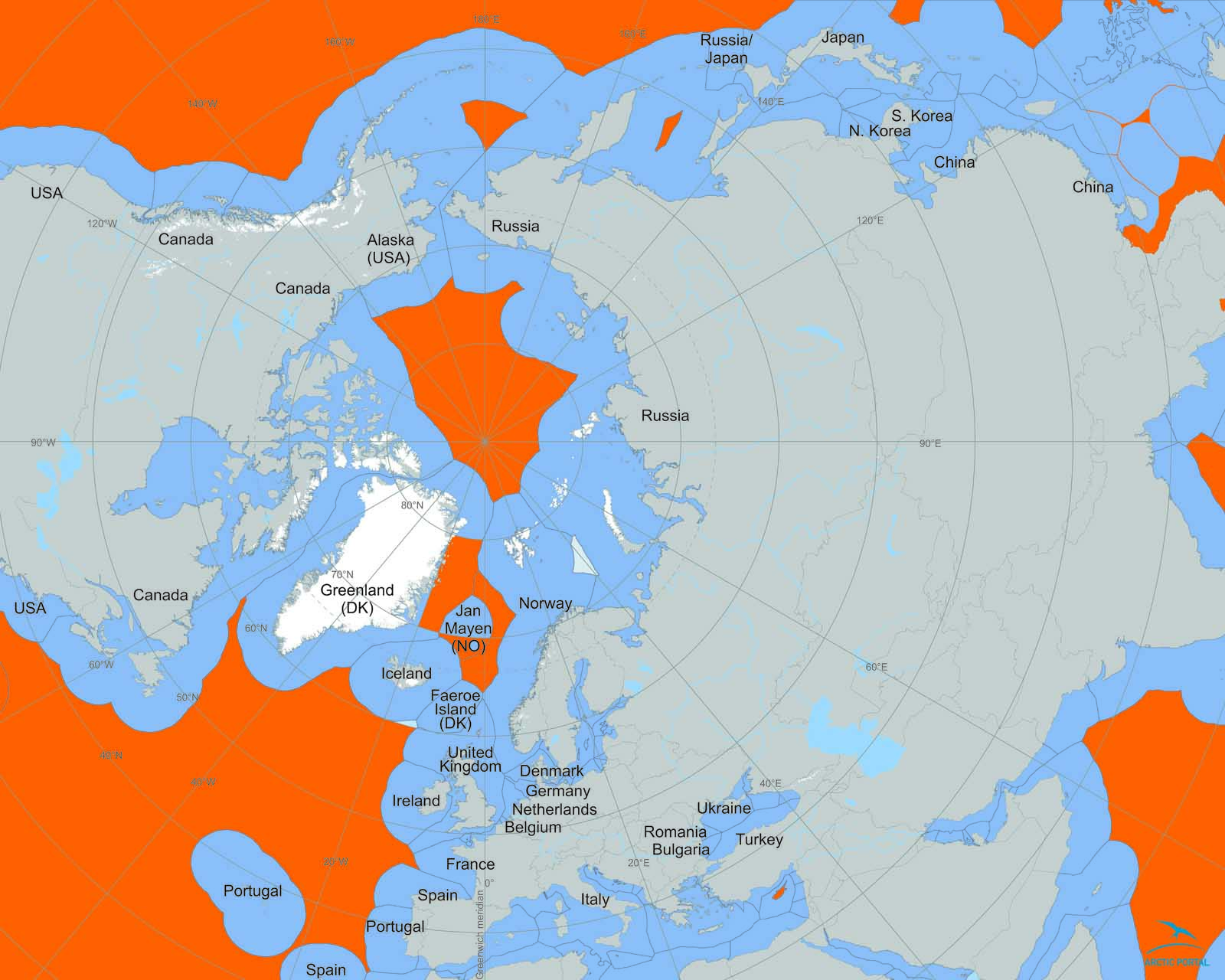
The fact is that no one owns the North Pole, but every country bordering the Arctic Ocean claims some of its parts.
The North Pole is covered by the thick layer of ice. The ice shelf is not considered land but water therefore it is governed by United Nations Convention on Law of the Sea (1982), signed by more than 150 countries.
The UNCLOS agreement allocates each nation control over the area up to 200 nautical miles (230 miles) of its cost and whatever natural resources can be extracted within this area.
This seemingly straightforward rule is complicated by another regulation that allows countries to extend their waters to up to 350 nautical miles (403 miles) if they can prove their underwater continental shelf extends beyond the normal 200-mile boundary.
So far, the Arctic Ocean has had a status of high seas, but after the discovery of the vast potential natural resources in the area, many Arctic states have started to re-evaluate their continental shelf.
When Russia planted a flag on the floor of the Arctic Ocean in August 2010, the country's aim was to show that a long ridge extends the Siberian continental shelf past Russia's 200-mile line, giving Moscow the rights to waters nearly all the way up to the North Pole. To do this, a nuclear-powered Russian ice-breaking vessel had to carve its way through the Arctic ice, and then dispatch two miniature research submarines down to the bottom of the ocean.
Of course, countries can't make formal claims just by planting a flag—they have to present scientific evidence demonstrating the size of their continental shelf to a U.N. Commission on the Limits of the Continental Shelf (CLCS) which then makes recommendations to coastal States.
Russia had appealed for more territory back in 2001, but the panel rejected the claim and requested more evidence. Part of the mission of the flag-planting Russian mini-subs was to gather data for a new petition.
What happens when countries' waters overlap? If the United Nations concludes that the lay of the seabed gives two countries rights to the same area, they can settle their boundary dispute independently or through a U.N. tribunal. So far, there haven't been any disputes like this in the Arctic, but researchers have yet to map the entire Arctic seabed. What's known of the topography suggests that Canadian waters may end up intersecting with those of Russia and Greenland.
Right now, the United States is the odd man out, legally, because it's the only country with Arctic interests that hasn't signed onto the Law of the Sea. (President Reagan refused the treaty because he thought it would hamper U.S. underwater mining.) While part of the UNCLOS has today customary international law status and the statements of the currents US leaders that the UNCLOS will be signed in near future, it remains to be seen whether the US reluctance to sign the treaty will have significant impact in the Arctic.